Showing posts with label Walking. Show all posts

Friday, 9 August 2019

Up and Down the Downs

This walk was from just past Kingsclere, towards White Hill, up to the ridge, along the gallops, then back down towards Echinswell and looping back to the car.


View of White Hill from near the start of the walk


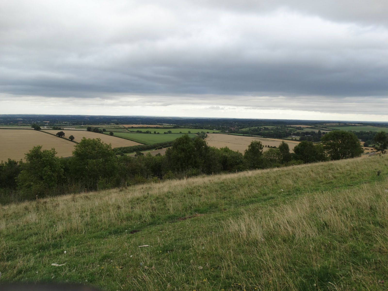
View from the top of White Hill looking towards the Hannington transmission tower


Looking down towards the start point which is at the end of the line of trees in the centre from the left.


View along the gallops towards Watership Down


Trying to spot Billie the Honda Jazz (end of the tree line in the centre of this photograph)


View towards the Iron Age hill for Ladle Hill and Watership Down


Old dead tree on the road down towards Echinswell


Another casualty


And one more fallen tree


White Hill Gallops - a warm-up walk

Parked Billie the Jazz in a lay-by on White Hill Road B3051 and walked up the hill to the gallops that form part of the Sydmonton Estate, currently owned by Andrew Lloyd-Webber. Walked to the top of of the gallops to the plaque for Richard Adams.


It was a beautiful evening and the view was fabulous


Walked back to the car again and headed home happy to have managed a decent uphill walk.


Saturday, 4 September 2010

Folly of the Week

This morning the sun was shining so on impulse we decided to conquer two more County Tops - Surrey (Leith Hill) & West Sussex (Black Down). We headed to Leith Hill (not far from Dorking) first as it has the most stunning folly built on the top. Leith Hill is the highest point in South East England and on a good day you can see St. Paul's Cathedral in London and The English Channel through the Shoreham Gap.

Our first glimpse of the Tower after a steep climb up the hillside from Windy Gap.


Leith Hill Tower in all it's glory. The gothic tower was built by Richard Hull in 1765 because he wanted to make Leith Hill over 1000ft tall. The hill is 965ft and the tower is 64ft high. On his death in 1772 he was interred under the tower, it is rumoured he was buried vertically, head down. The tower fell into disuse and was filled with concrete and rubble.

In 1864 a Mr Evelyn sought to reopen the tower but the concrete made it difficult, so the turreted side tower was added to give access to the top.

The Tower was fully restored by the National Trust in 1984.


As dogs aren't allowed in the Tower we took turns to keep Charlie company. Alan went first and took this picture of me from the top.


Two panoramas from the rooftop.


Looking North towards Box Hill (the hill with three stripes of chalk just left of centre) where the Bennet's had a picnic in Pride & Prejudice. Behind Box Hill and further in the distance the ghostly outline of Canary Wharf in London can be seen.


My turn! And a picture of Alan relaxing with Charlie.


About two-thirds of the way across (left to right) on the horizon is Black Down, where we were heading next.


Walking down the perilously steep spiral staircase. It's only lit by the camera flash in this picture and a couple of small and ineffective windows.


The gothic style window in one of the two rooms at the top of the tower used as exhibit rooms


The steep steps back to the car and on to our next destination


View from the top of Black Down


Some boys never grow up and will always climb trees!


Charlie took a dip and a drink in the only water he could find on the top of Black Down, I wonder if that's how it got it's name??? We were on our way back to the car and had water for him there but he saw the mud and slipped in.


Walking back down the hill, we found a less steep route back than the one we'd taken to the top


As we walked on, through a gap in the trees we caught a glimpse of the car. Serendipity, we managed to end up coming out of the hill at almost the same spot we had set off! It seems sometimes we do much better without a map!


On the road to Haslemere we found grass growing in the middle of the road.


Sunday, 29 August 2010

Dragons and legendary creatures

As the weather seemed fair enough this morning we decided to conquer our 5th county top (Oxfordshire) - and also planned to visit Silbury Hill later in the day if time allowed. As is usual we missed our turning and then decided to visit Silbury Hill first followed by Uffington and White Horse Hill. On the way to Silbury Hill we stopped at The Sanctuary in Avebury - a circle monument that was originally formed of wooden poles and later standing stones. The circle was destroyed in 1724 to allow the field to be ploughed. In 1930 the site was excavated and the post holes were marked with concrete. Many human bones (incuding an adolescent interred in a pottery jar) were found here and it is thought that some kind of ritual sacrifice may have taken place here.


You can see an aerial view of the stones here to get a better idea of the layout.

On to Silbury Hill, the Europe's largest man made neolithic monument. In 2007 it was suggested that the hill was originally constructed in a spiral and that the spiral may have served as a processional walkway to the flattened top. The hill would originally have been bare chalk and would have stood out against the greenery all around. No burial site has been found here. There is no public access to the hill but it's an awe-inspiring site from the viewing point. It has been calculated that it took 18 million man hours to build (equating to 500 men working for 15 years) using only rudimentary tools - antlers and pickaxes.


Onwards to our main destination, the White Horse at Uffington. This view was taken looking North from White Horse Hill.


Picture taken from the head of the horse looking towards Dragon Hill


You can't see the horse from the ground very well as it's on a 30-degree slope, the best view is from the air (video of the horse). What makes this remarkable is that the horse was first constructed in the bronze age, approx 1000BC and has been maintained throughout history never being lost under the downland.


Similarities have been made to the Silchester Horse found in the Roman dig (though believed to pre-date Roman Britain)


Looking down on Dragon Hill, a natural escarpment with a flattened top. Legend has it that this is where St. George slew the dragon and that vegetation doesn't grow where the dragon's blood was spilt.


Alan and Charlie (on the Trig Point) on White Horse Hill
261 m (856 ft)


As you can see from my hair it was a bit windy!


Looking back at the horse from Dragon Hill - trying to stay upright felt like Hill Surfing! This is probably the best view of the horse from the site, you can get a slightly better view from the road to Avebury but it's a very busy and fast road with only a few places alongside to park.


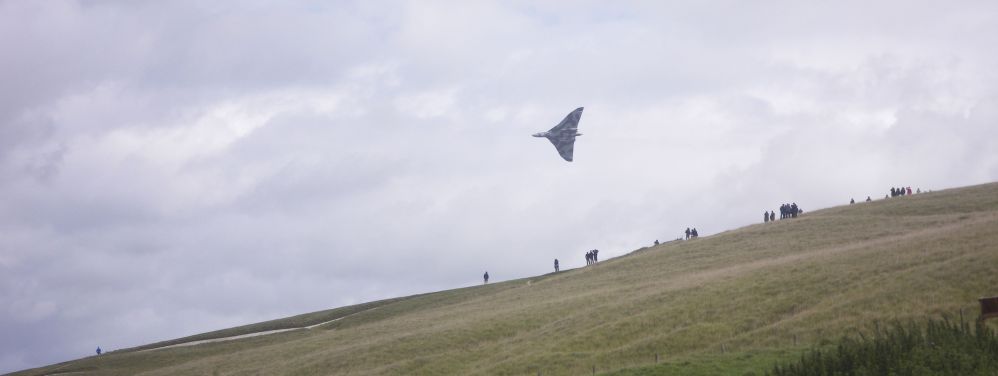
And as we were walking down the hill back to the car we heard a familiar roar and could hardly believe our luck as XH558, the only surviving Vulcan bomber (she's 50 this year) flew low over the hillside. After circling twice she roared off to the North. I have loved this beauty since watching her grace the skies at the airshows I visited as a child.


This was a low altitude flypast much to the delight of everyone on the hill. Alan saw her fly last year at Cosford but I wasn't with him so this is the first time we've been together and seen her fly.


Sunday, 25 July 2010

Kinder surprise

A visit to Staffordshire to see Alan's mum for the weekend and we decided to use one of the days to make a trip to Derbyshire to climb another County Top - Kinder Scout

The view of the High Peaks from Edale

At the top of Grindsbrook Clough (almost) - had I known the climb was going to be that difficult I don't think I would have started this climb but we made it to the top.

Taking in the view and having a rest - had to take a picture of Alan on these rocks.

One of my resting against a nearby rock, there were plenty of rest stops along the way.

Standing on another rock, this one made me think of a animal head or snout.

Looking down towards Edale

Peat marshes that cover the top of Kinder Scout. Severe erosion has been caused by over-grazing sheep. This was really hard going, though we found you could walk on a lot of the marsh along as you didn't jump!
Adding a small stone to the top of a cairn.
Of course someone had to add a much bigger stone...

Kinder Gates

My Titanic moment near Kinder downfall - looking towards Kinder reservoir.

Kinder downfall - a mere trickle in the summer - the highest waterfall in the Peak District

At the Triangulation Point on Kinder Low - 633m

The walk down towards Jacob's Ladder, terrain was a little tricky in places
The view from Jacob's Ladder - only a few miles to the car now, almost 10 miles in total though it felt more because of the difficult terrain. This is definitely not a walk for the faint-hearted. We were lucky as the weather was fabulous, but even so the top was very windy and exposed.

Related Posts with Thumbnails